Inundaciones
Instituciones nacionales
- UNGRD. Link
- IDEAM. Link
- Minambiente. Link
- Fondo Adaptación
- Bomberos de Colombia. Link
Instituciones internacionales
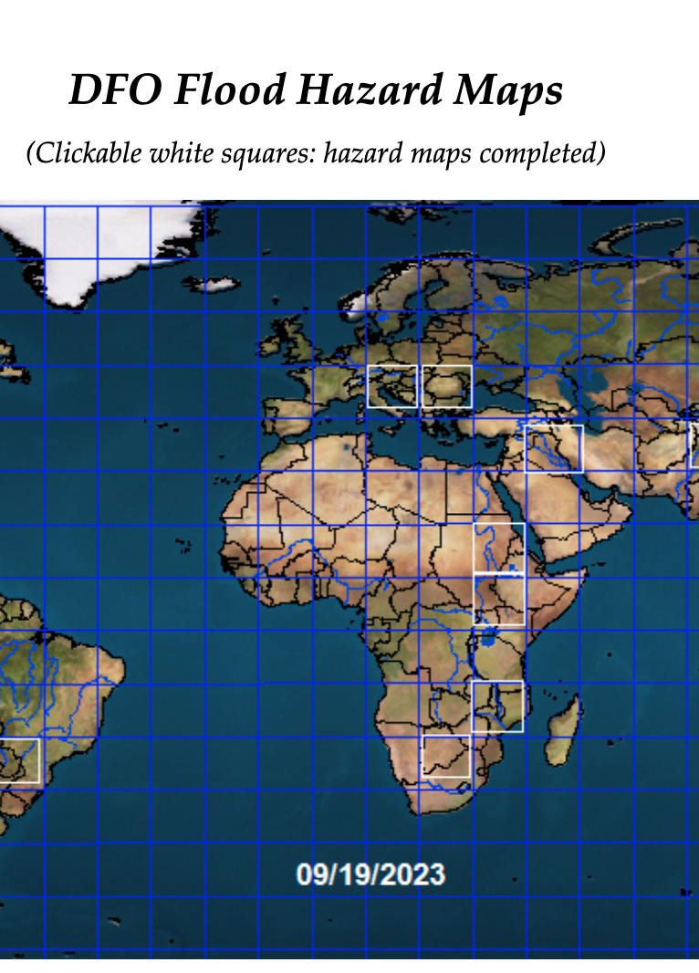
Amenaza por inundaciones
Manchas de inundación Cordoba. Fondo Adaptación. Link
Inundaciones en La Mojana: cómo los servicios de observación de la Tierra están transformando la gestión de riesgos en Colombia. Copernicus. Link
- FEMA. Hazus. Link
- Europe floods: new tool to estimate water depth and extent. 2024. Link.
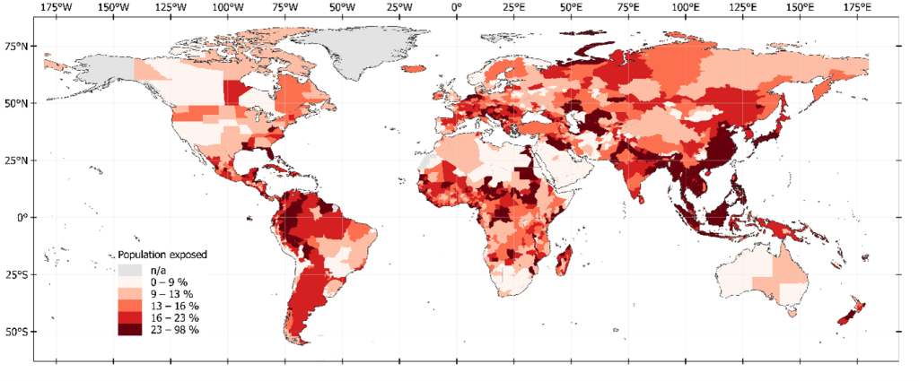
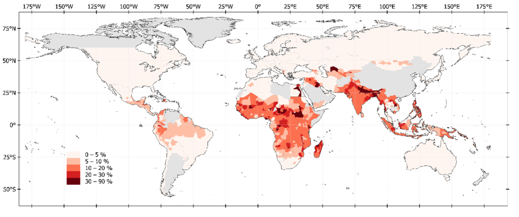
- Satellite imaging reveals increased proportion of population exposed to floods. Nature, 2021. Link.
- The fraction of the global population at risk of floods is growing. Nature News. 2021. Link.
- ARSET – Monitoring and Modeling Floods using Earth Observations. NASA. Link.
- Global Floods. Link - What’s in Floodwaters? Link.
- ***Overview of Web Maps for Flood Monitoring. Link
Part 1: Overview of Flood Monitoring Tools based on Remote Sensing Observations
Introduction to Flood Risk Management
Evaluación del riesgo por inundaciones
Comunicación del riesgo por inundaciones
Flood risk communication: a fundamental tool for disaster risk management. Prevention web. Link
Flood Risk Communication Toolbox. US Army Corps of Engineers. Link.
Bridging the gap in flood risk communication: a comparative study of community and organizational social media posts using natural language processing. 2025. Link
How to Communicate Flood Risk to the Public
Reducción del riesgo de inundaciones
Planning for Safety: How Land Use Decisions Shape Flood Risk. LinkManejo de desastres por inundaciones
Lecturas
Entrenamiento
- NASA: ARSET - Monitoring and Modeling Floods using Earth Observations. Link
Repositorios
- A Collection of NASA ARSET Courses for Flood Mapping and Synthetic Aperture Radar (SAR). Link.